| TRAINMASTER
BY WERNER MEER US-RAILROAD-SHOP KILCHBERG HOCHWEIDSTRASSE 3 CH-8802 KILCHBERG (ZÜRICH) SWITZERLAND (founded 1977) PHONE *41-44-715-3666, E-MAIL trainmaster@bluewin.ch Go back to our Website - click here |
updated: January 17, 2026
|
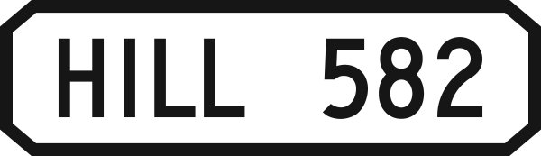
HILL 582 CAJON PASS, CALIFORNIA |
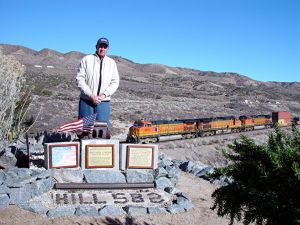
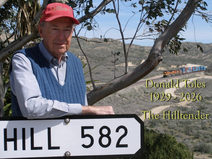
| Written by Don E. Toles, July 2010 (Co-founder of Hill 582, also known as the "Hilltender") |
 |
| Don Toles (click to enlarge) - 623 |
| WELCOME to Werner Meer's Hill 582 home page. Known by railfans the world over, Hill 582 has become a popular international destination, mainly due to Werner Meer's web site and his leadership in the AMERICAN RAILROAD FANS IN SWITZERLAND organization. Werner owns a model railroad equipment store in his home town of Kilchberg, a suburb of Zurich, Switzerland. Werner's shop specializes in all things pertaining to American railroads. DET |
| This is the Hill 582 Main Page |
 |
History of Hill
582 The Early Years 1991 - 2006 by Don E. Toles Updated: 1/27/26 |
 |
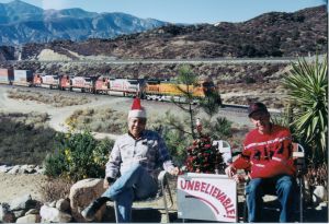
| 12/01 - Gary & Don X-Mas 2001 - 068 | Read it and see all 108 photos - click here | 4/9/06 - Chard Walker, Don, Karl, Gary - 105 |
 |
History of Hill
582 The Late Years 2008 - 2023 by Don E. Toles Updated: 1/17/26 |
 |
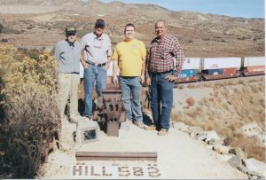
| 12/29/08 - Triple meet, WB & 2 EB trains - 8139 | Read it and see all 498 photos - click here | 12/29/08 - Don Toles w/memorials - 8140 |
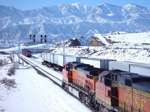
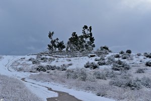
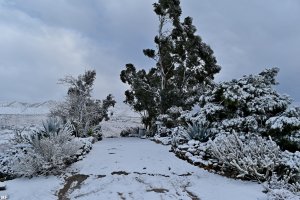
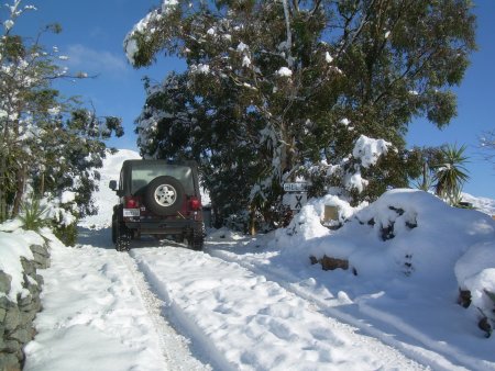
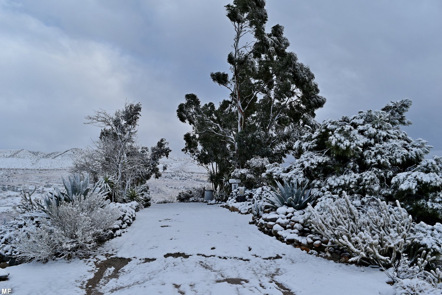
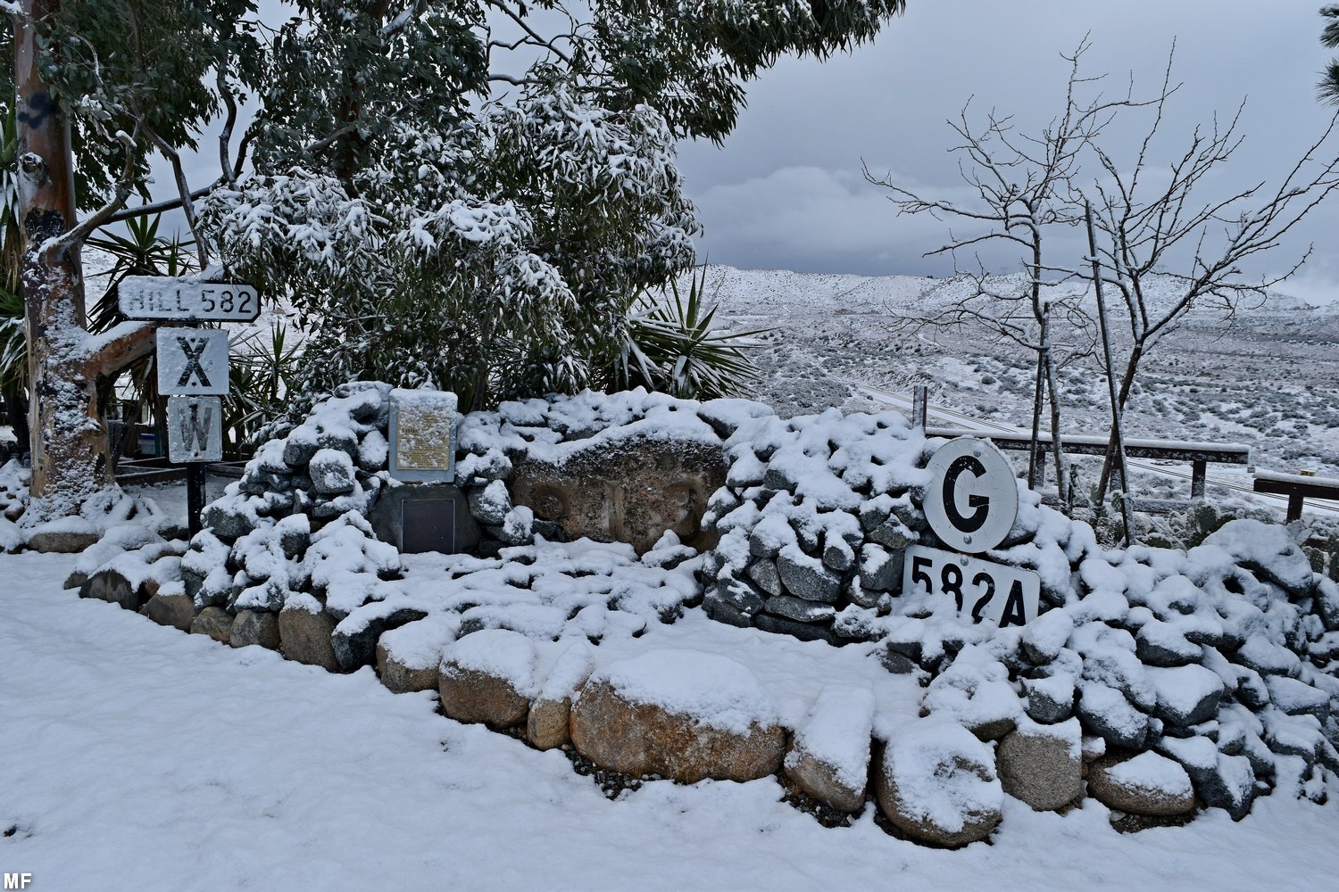
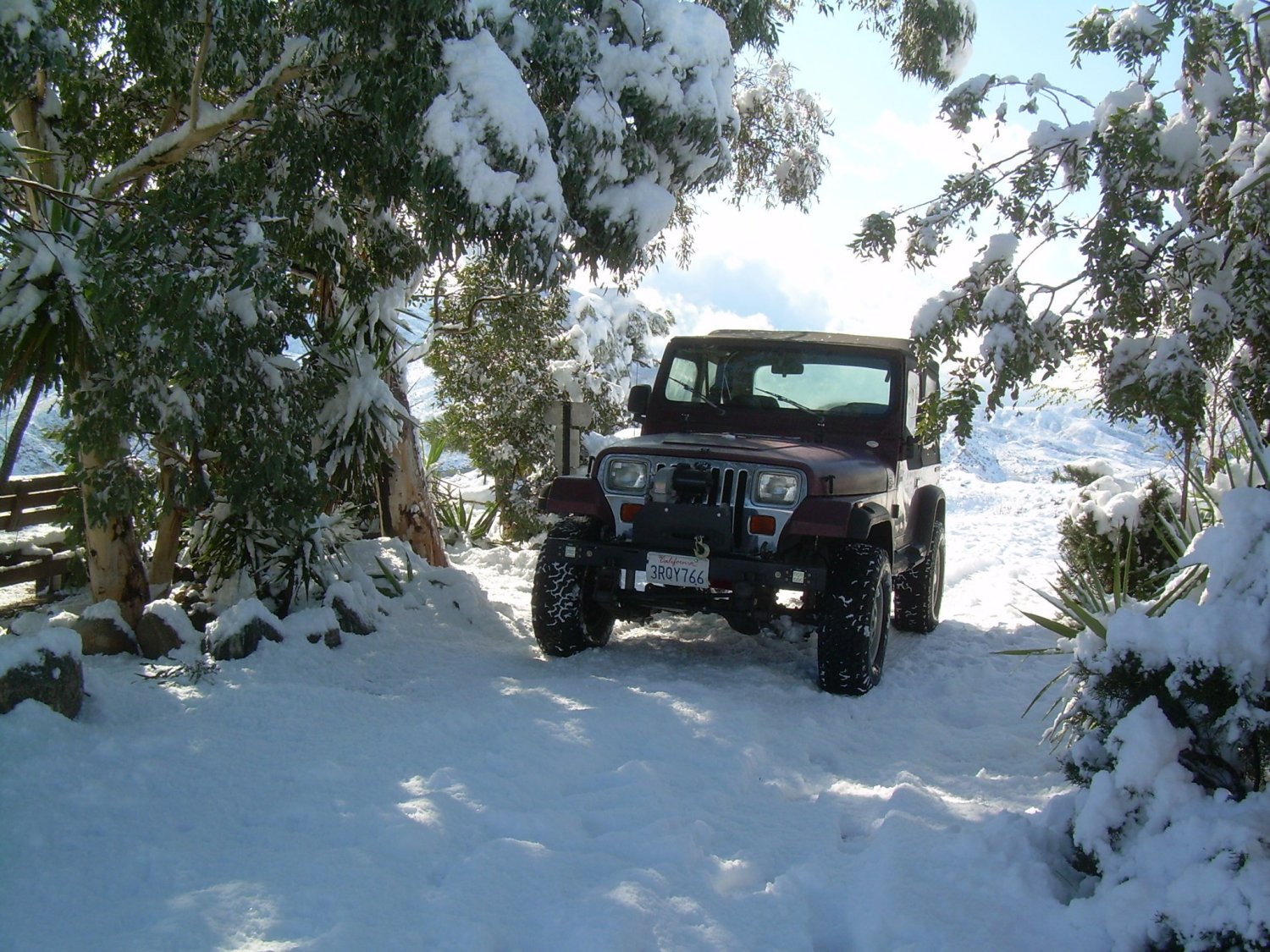
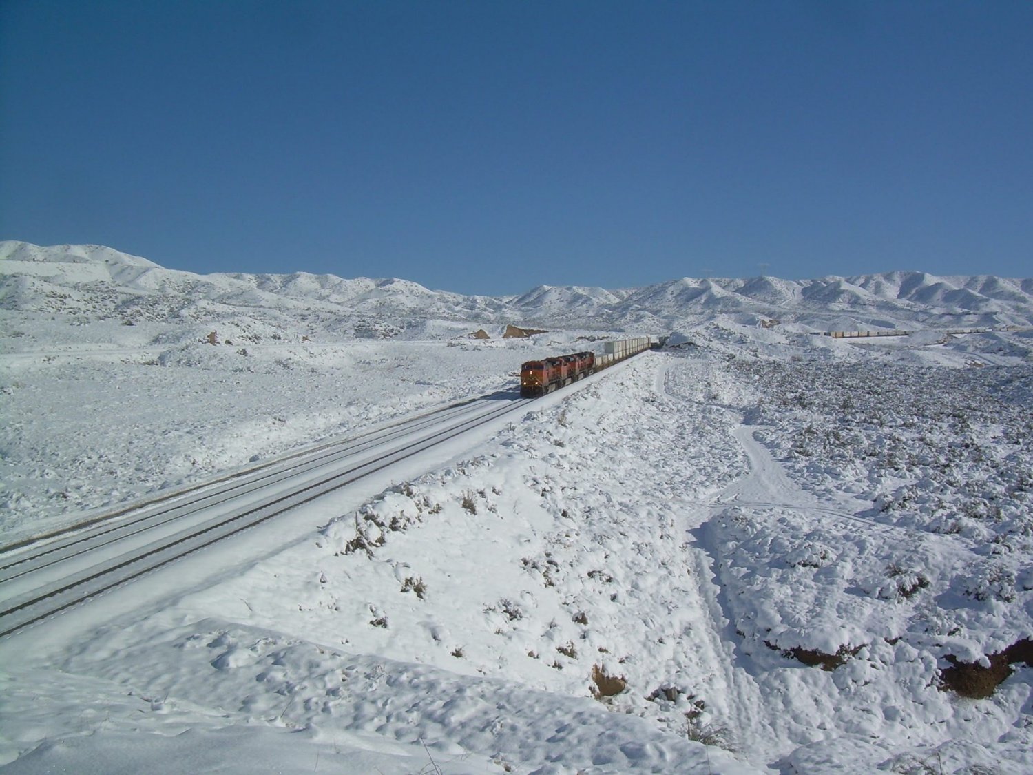
| Late January 2021: Snow on Hill 582 | ||
 |
 |
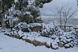 |
| MF 1/21 -
1007 West side of Hill 582 |
MF 1/21 -
1008 on top of Hill 582 |
MF 1/21 -
1009 Memorials on Hill 582 |
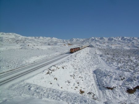
| November 29, 2019: Snow on Hill 582 | |
| The day after Thanksgiving 2019, Bill Pounds found Hill 582 with quite a lot of snow. | |
 |
 |
| BP 11/29/19 Winterwonderland on Hill 582 - 9175 | BP 11/29/19 Beautiful and unusual scene - 9176 |
 |
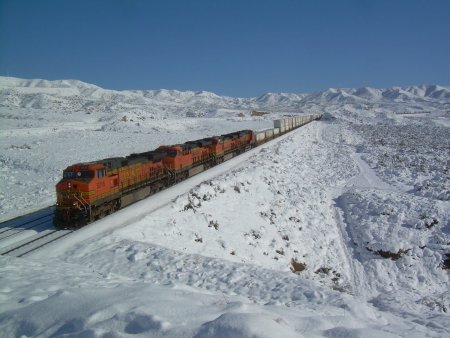 |
| BP 11/29/19 Looking East from Hill 582 - 9177 | BP 11/29/19 BNSF WB on MT-2 passing Hill 582 - 9178 |
| We are very thankful in showing these 4 photos taken by Bill Pounds (with permission by BP) | |
| New 7/19: Accurate Map of Cajon Pass as of 2018 by Steve Jessup & Todd Gillette (RR Illustrated) - click here |
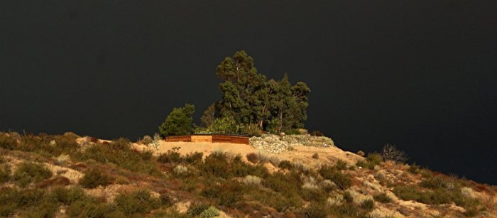
This exclusive photo with the dramatic dark sky was
taken by Don Toles on 11/19/11
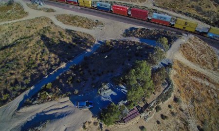
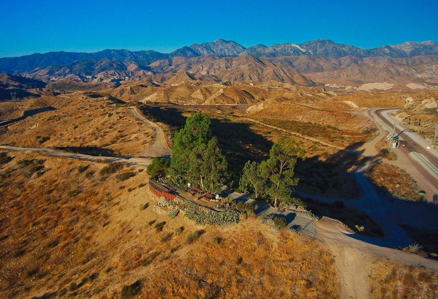
| August 6, 2018: Contribution by Bob Russel - Hill 582 | |
|
Bob Russell created a new facebook group
about Hill 582: https://www.facebook.com/groups/2165629727028091/ I got the permission to use his great photography including some outstanding drone pictures. Thank you Bob, Werner |
|
 |
|
| BR 8/06/18 Beautiful overview from the East side taken with a drone - BR-01 | |
 |
 |
| BR 8/06/18 accurate map - way from Hwy 138 to Hill 582 - BR-09 | BR 8/06/18 The Hill from the air - BR-10 |
Below is a map with direction to access Hill 582
(just scroll down).
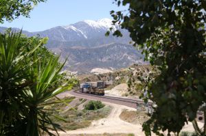
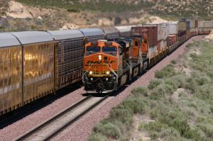
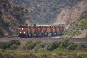
Second in popularity only to California's Tehachapi Pass and
the famous Tehachapi Loop, Southern California's Cajon Pass attracts rail
enthusiasts
from throughout the United States and Canada as well as many foreign
countries world-wide.
 |
 |
 |
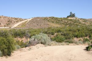
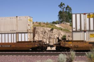
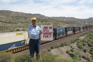
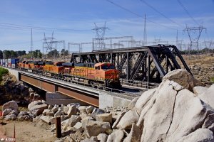
| WM 5/31/10 South/East side - 3037 | WM 6/1/10 West side w/MT-1 & MT-2 - 3206 | WM 6/1/10 Railfans walking to the Hill - 3338 |
 |
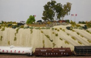
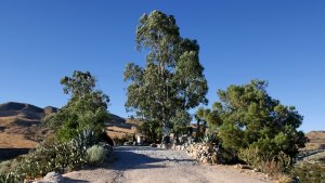
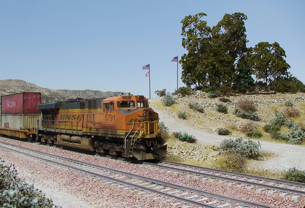
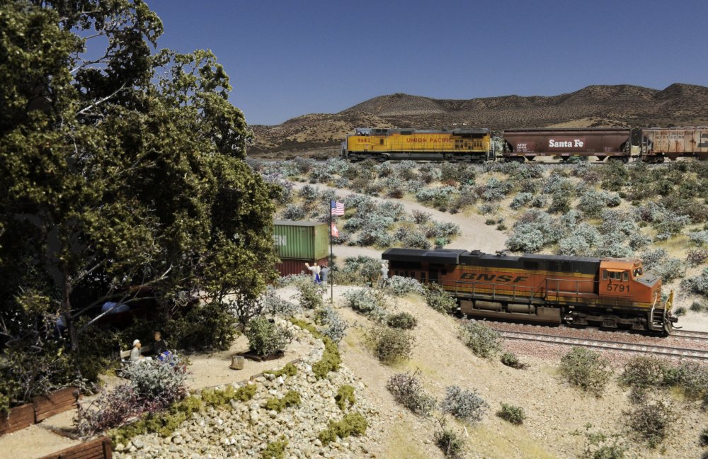
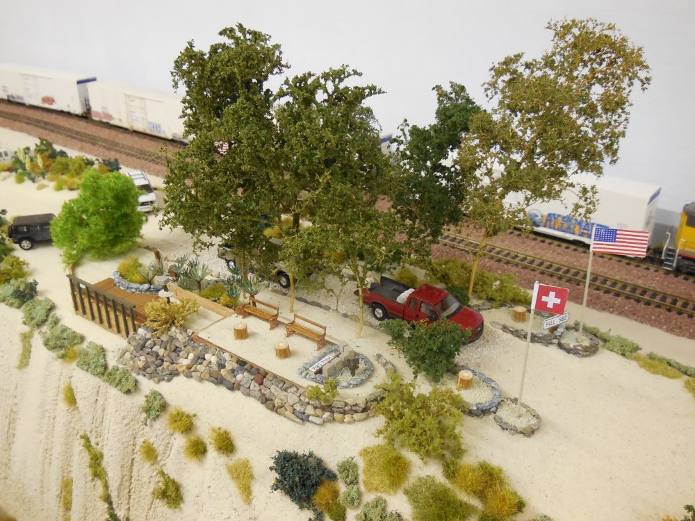
Hill 582
in HO Scale on a Diorama with exact arrangement of tracks Page 1/1 Built by Kim Nipkow (Switzerland) Updated: 3/12/13 |
 |
| 3/12/13 Do you believe - it is HO scale - 205 | See all photos - click here | 3/12/13 Hill 582 diorama in HO scale - 206 |
 |
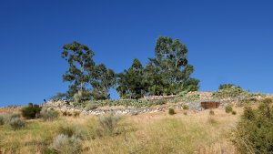
Hill 582
in HO Scale on a Mojave Desert Layout (turned by 90° to the tracks) Page 1/1 Built by Werner Meer (Switzerland) Updated: 11/19/15 |
 |
| Hill 582 in HO scale (Swiss made) - 1843 | See all photos - click here | 11/19/15 it is 90° to the tracks - 2372 |
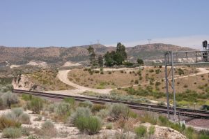
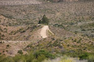
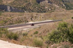
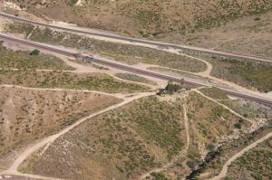
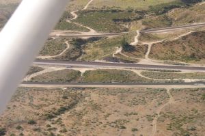
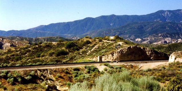
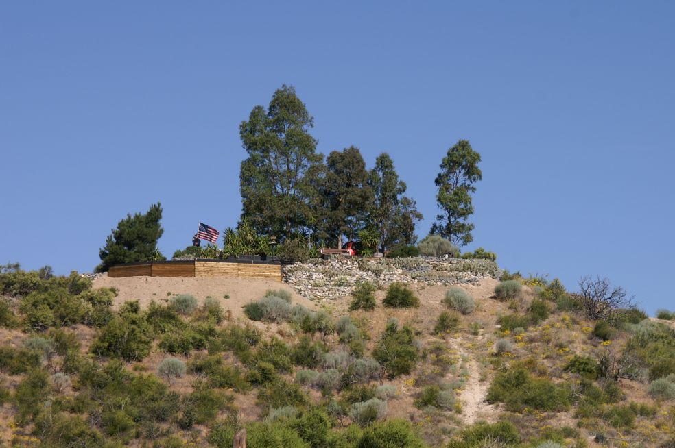
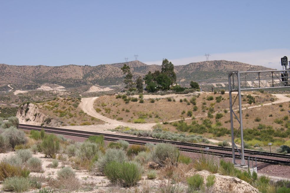
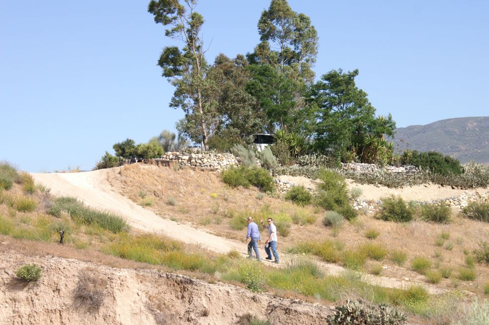
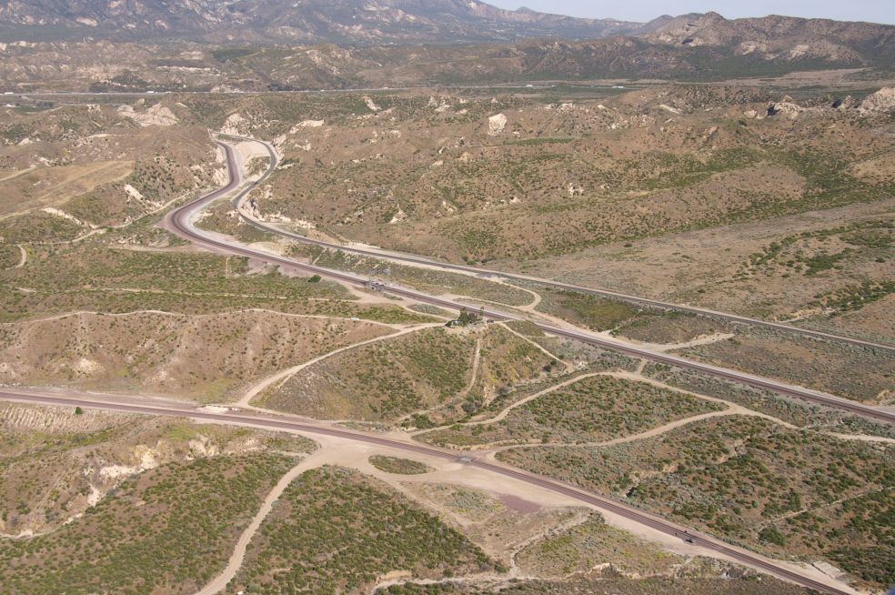
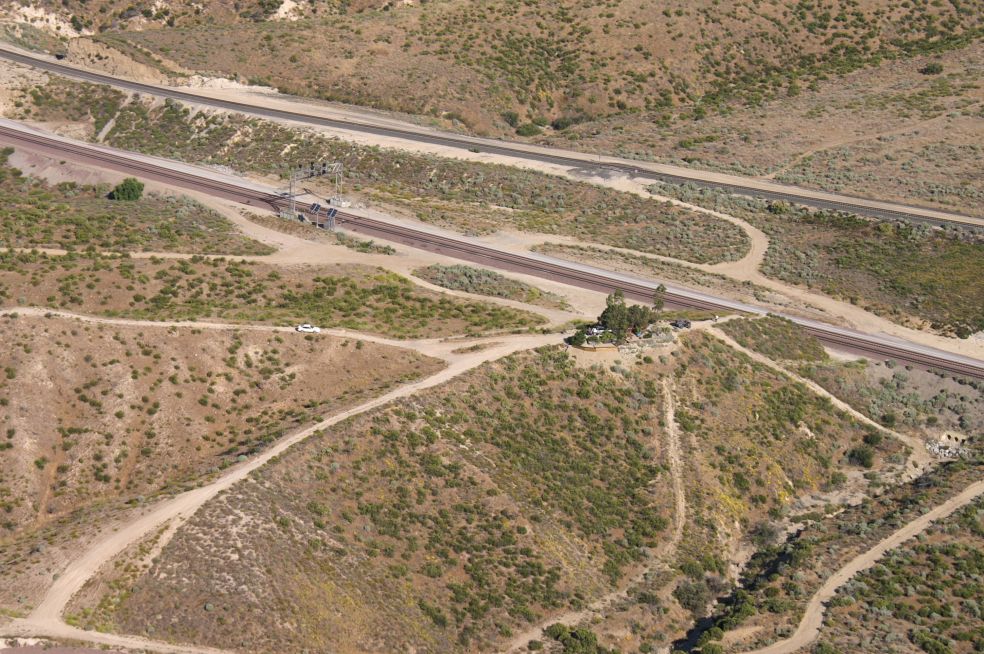
| Hill 582 is located in the San
Bernardino National Forest on United States Forest Service (USFS) land, thus
making it accessible to the public. It is strategically located in the upper
Cajon Pass approximately two miles below Summit at an elevation of 3621 feet.
The BNSF #1 and #2 main tracks pass through a cut at the north end of Hill 582,
and the steeper BNSF #3 main track passes by the south end of the Hill. The
Union Pacific's "Palmdale Cutoff" main line runs parallel to BNSF a
short distance north of the #1 and #2 tracks. Prior to 2001, access to Hill 582
from State Route 138 was provided entirely by USFS road 3N48 without the need to
drive on BNSF right-of-way roads. Unfortunately, BNSF permanently removed a
paved crossing at the northwest corner of the Hill in 2001, making it necessary
to drive a short distance along the BNSF right-of-way road on the north side of
track #3. Detailed directions for driving to the Hill from SR 138 using USFS
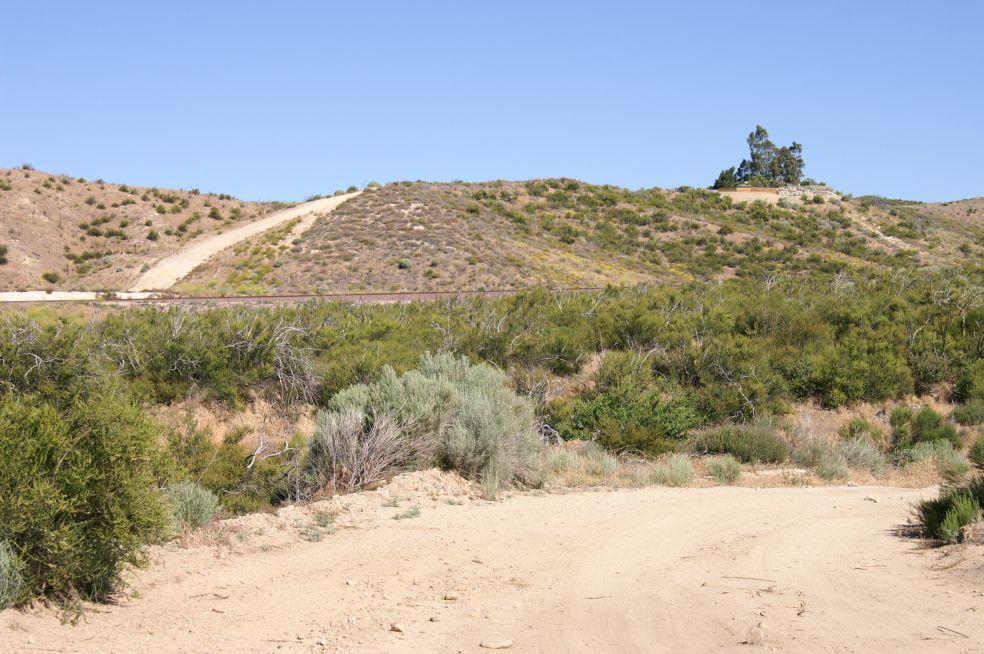
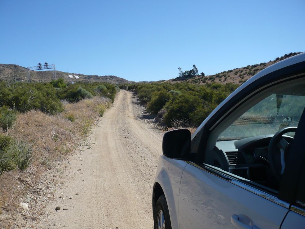
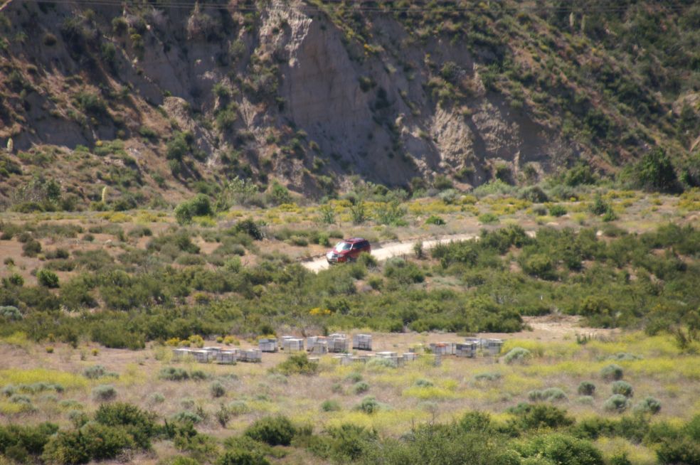
road 3N48, also known as Parker Ranch Road, can be found below. Since Hill 582 commands views of railroad tracks in virtually all directions, it is very popular among railroad photographers. Perhaps the most photographed view in the entire Pass is from Hill 582 looking west during the winter months towards the BNSF tracks with the snow-covered San Gabriel Mountains in the background. Hill 582 is also a popular rest spot for off-highway vehicle enthusiasts that frequent the upper Pass. Bird-watchers also gather on the Hill, as a constant supply of seed is provided for the birds in a feeder on the east side of the Hill. A wide variety of birds are attracted to the Hill - from large black ravens to tiny irradescent hummingbirds. Ground squirrels are common, and during the night, rats and mice are said to be all over the place. The rodents attract several snake varieties, including Southern Pacific rattlesnakes, King snakes and gopher snakes. Lizards also are abundant, and cottontail and jack rabbits are once again being seen. Rabbits have been scarce since the major brush fire that scorched Hill 582 in June, 2002. Tarantula sightings have become rare, but black widow spiders are common some years and scarce others. |
| Access to Hill 582 |
| March 24, 2018: Don Toles made a run up to the Hill this morning - new SR-138 was open and in use but he took Baldy Mesa Rd and the BNSF ROW road along tracks 1 & 2 to reach the Hill. A few muddy spots along the way, but only minor storm damage. All was well on the Hill - ground is damp, but the rainfall must have been light at best. Cold 46 F. and windy. On the way out he drove to Summit along the SP/UP track and then took the new highway back down to the Jct. Then he drove back up 138 and took Parker Ranch Rd. from off the new 138 - wide open, no gate or Road Closed sign. Hope they'll keep it that way! DET |
|
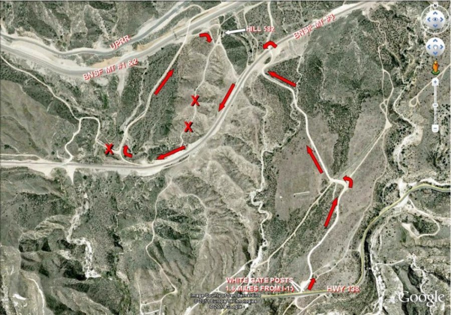
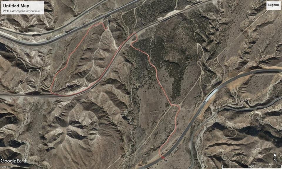
Below is a Google map showing directions to
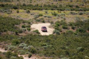
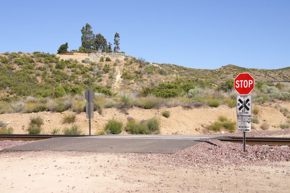
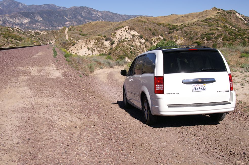
Hill 582. Here is an edited Google map showing the most common route used to visit Cajon Hill 582. Yearly, hundreds of railfans visit the Hill without incident, however we feel it necessary to enclose several "cautions". Hwy 138 is a very narrow, winding and high-speed road. The turn onto the Hill 582 road can be dangerous. The turn-off is 1.6 miles from I-15. The road crossing of BNSF MT-3 deserves considerable caution. The dirt roads leading to Hill 582 (1.3 miles) are NOT maintained and are very rough. We see numerous automobiles on the Hill but a vehicle with some clearance is recommended. On the map, the roads with a large red X should NOT be used. Snakes and Bee Hives are common throughout Cajon. Rattle Snakes are seen frequently. Children and pets should be closely monitored when visiting all areas of Cajon Pass. Common sense rules of exploring any desert should be adhered to. So far, the USFS and BNSF have "tolerated" our presence on Hill 582. Please respect the land and stay away from the tracks. The Hill 582 Bunch (GGG & DET) 7/27/11 |
 |
| March 5, 2011 - The unpaved road into Hill 582 from State Route 138, designated as 3N48 on some US Forest Service maps, is not regularly maintained by any government agency. Above average rainfall this winter has caused some damage to the road. Currently the road is passable for most vehicles, but drivers of vehicles with limited clearance should be extra-cautious. |
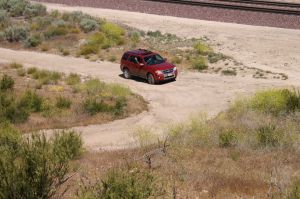
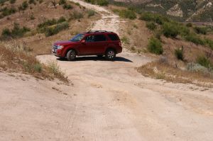
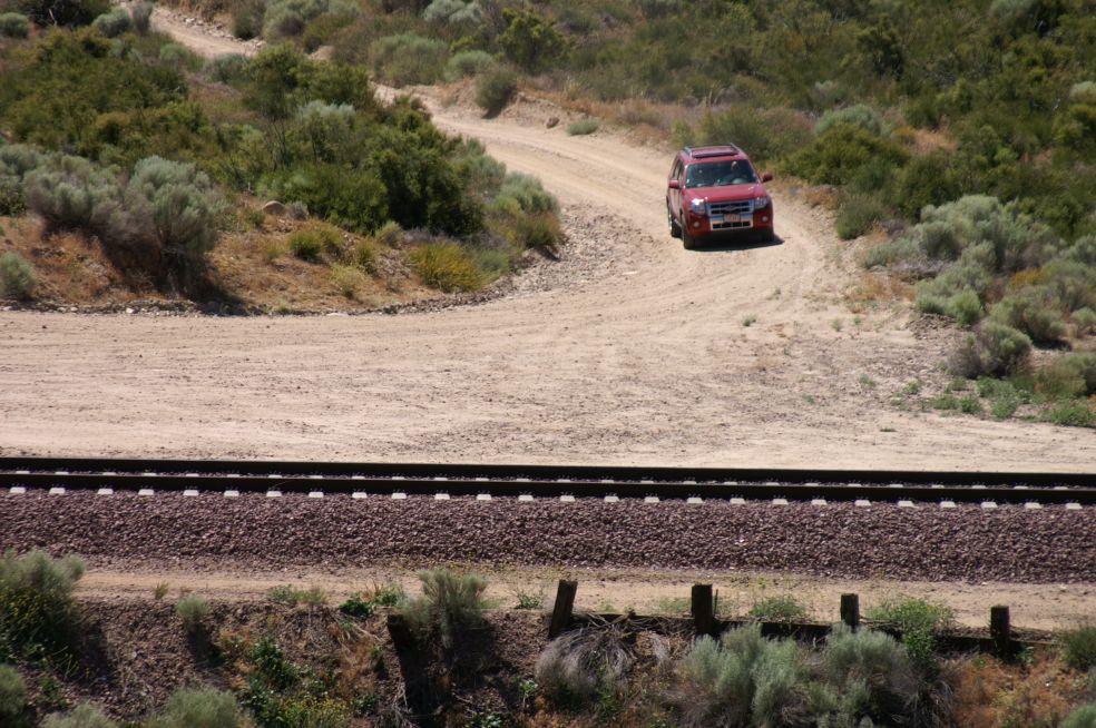
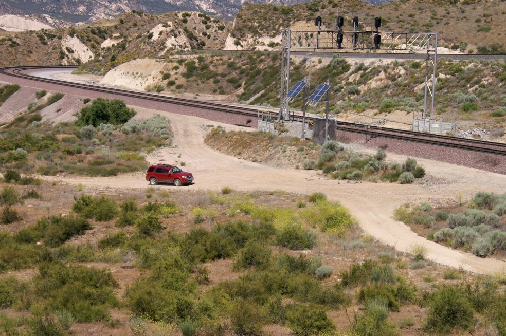
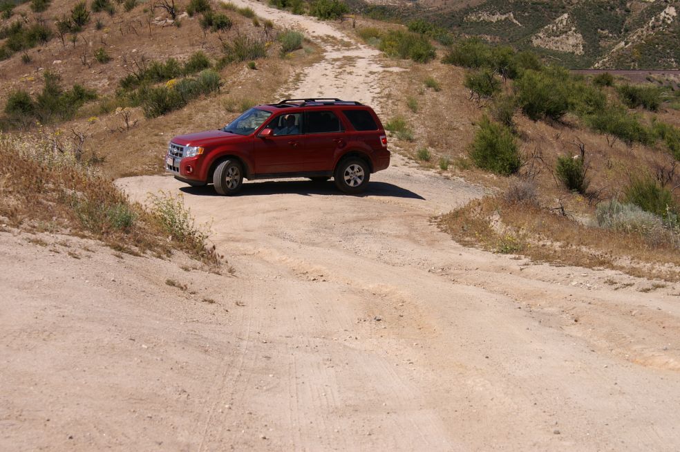
| How to find Hill 582 ? | ||
|
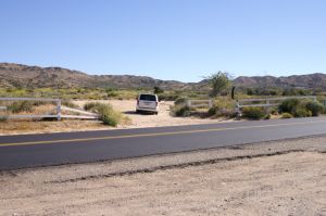
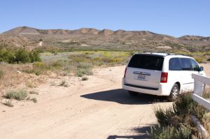
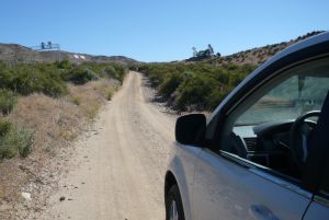
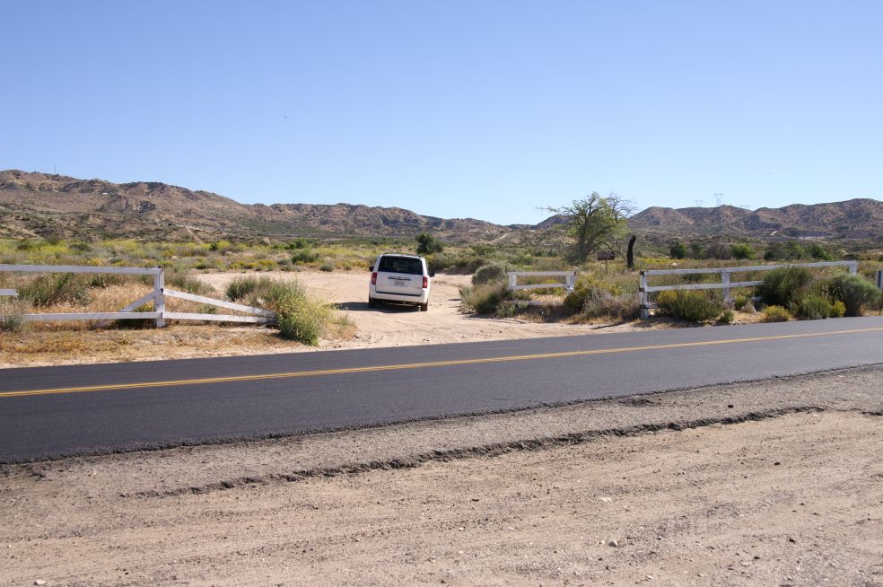
To reach Hill 582, drive
east on highway 138 (left turn when leaving the Best Western motel,
crossing over the I-15) for approximately one and a half miles. Watch
for a rather broken down, white wooden fence on the north/left side of
the highway. You will see a dirt road (1344) that passes through the fence. The
road is in poor condition from the winter rains, but it is passable for
a rental car. The trees on Hill 582 (1346-1347) are visible in the distance
looking north from the road.
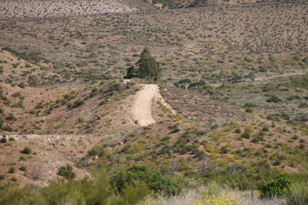
Follow the road north until the
road makes a jog to the left and then to the right. At this
point you are crossing a road that follows an underground pipe line. The
road is in bad shape just before crossing the gas line road, so
keep to the left edge of the road in order to get across a wash-out
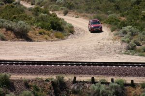
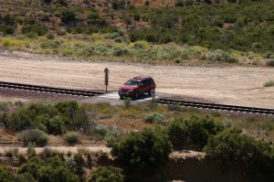
ravine. Continue north until you come to the railroad tracks (1352 -
BNSF track
# 3). Cross the track, turn immediately to the left and follow the
right-of-way road next to the tracks until you come to a point
where the road leaves the tracks (1355) and curves to the right/north.
You'll soon come to an intersection with a road that heads west, but do
not turn into that road, but continue on north, up a short but
steep hill (5226), and then continue until you reach Hill 582 on your right.
Avoid the steep road at the north end of the Hill. The road to the right
is the better road to reach the top of the Hill. This will all make
sense to you when you see the Hill up close. (April 2010 DET)
|
||
|
|
|
| From Hwy 138 make a left here - 1344 | You can see the Hill in the distance (left) - 1346 | Close up of Hill 582 - 1347 |
|
|
|
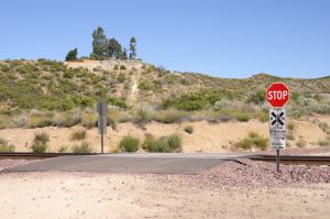
| About half way - 1349 | BNSF MT-3 RR-X-ing - 1352 | Close up of Hill 582 - 1353 |

|
|

|
| Follow BNSF right of way and go to the right - 1355 | Left signal bridge MT-1/-2, right is the Hill - 5226 | Top of Hill 582 - 2005 |
| These photos below show the view as seen from top of Hill 582. | ||

|

|
|
| Just coming from Hwy 138 - 2031 | Here, make a left turn - 2032 | Going down and afterwards up - 2033 |
|
|
|
| BNSF MT-3 (look for RR-Xing) - 2034 | Stop - Look - Listen (make left turn) - 2035 | Follow BNSF service road - 2036 |

|
|
|
| BNSF MT-1/-2 w/Signal bridge - 2037 | Make right turn - go uphill - 2038 | You made it to the top - 2039 |

|
|
|
| Hill 582 from the air, looking West - 4032 | Hill 582, BNSF MT-2/-1 and UPT - 4033 | Looking South, UPT, BNSF MT-1/-2 and MT-3 - 4086 |
| SAFETY ISSUES ON HILL 582 |
|
Families are welcome on
Hill 582, and it's a great spot to have a family picnic. Visitors need to be
vigilant in watching for rattlesnakes from April through October. Children
should be cautioned to watch where they are stepping, and they should not be
allowed to run around in the dense brush during rattlesnake season. Equally
important, parents must not permit their children and pets to play near the
railroad tracks. Placing coins or any object on the rails is dangerous and
should not be allowed. Children and railfans standing next to the tracks make
train crews nervous, and it also places Hill 582 in jeopardy as the Hill is
deemed responsible for attracting the people that trespass on the railroad's
right-of-way. An ADVENTURE PASS is required in some areas of the San
Bernardino National Forest. An Adventure Pass is essentially a parking permit.
Most of Cajon Pass is a no-fee zone, including Hill 582, so an Adventure Pass is
not required for visitors to Hill 582. WOULD YOU LIKE TO HELP preserve and perpetuate Hill 582? Although a large trash container is stationed on the Hill, a small percentage of visitors leave their trash and cigarette butts on the ground and throw their cans and bottles over the sides. The Forest Service has warned us not to let the Hill become a "magnet" for trash, so we are ever diligent in keeping the place tidy and trash-free. Visitors can help by placing their trash in the large container and also by picking up any trash that others have left behind. It would also be helpful if visitors would carry out their own trash when they leave the Hill. WATER and BIRD SEED are Hill 582's most urgent needs. The birds consume approximately 25 lbs. of seed weekly, so donations of wild bird seed, sunflower seeds and unsalted peanuts-in-the-shell are greatly appreciated. Bird seed is stored in a bucket near the note book box. Visitors are asked to fill the nearby bird feeder if it is getting low on seeds. Currently (July 2010) there are two of us that bring irrigation water to the Hill for a combined total in excess of 400 gallons weekly. Small quantities of water are also helpful. Regular visitors are encouraged to bring a few gallons of water with them when they visit the Hill. Small quantities of water are most effective when dumped at the base of the pine trees and rosemary plants. Pine trees are not well-suited for the harsh desert environment of Cajon Pass, but since the Forest Service donated the pine trees more than a decade ago, we try very hard to keep them alive and well-watered. The LEAVE-A-NOTE BOX located near the Tony Andel Memorial Bench contains notebooks and business cards. Visitors are invited to write a note in the current book. Business cards are also welcome. |
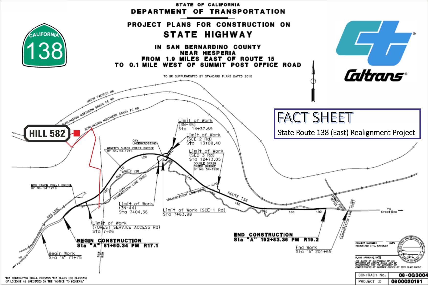
| May 31, 2018: Highway 138 (East) Realignment Project is completed. |
|
For all who are familiar with Hwy 138 while
visitting Cajon Pass, are aware of the old two lane and curvy Highway 138
coming from exit # 131 (I-15) and going to Summit. Several years ago, Hwy
138 has been widened after the exit toward Summit for the first 1.9 mls. But
from that point up to Summit, it is a curvy up and down slow speed
(mountain) road. Three bridges and one undercrossing will be built. (Hog Ranch Creek Bridge, Vjner's Shack Creek Bridge, OHV Undercrossing, Double Drajn Cheek Bridge) |
 |
| Map copyright by Caltrans and RUS - 6214 |
|
more infos:
http://www.dot.ca.gov/dist8/documents/sr138/SR-138-EAST-ALIGNMENT-FACT-SHEET-070716.pdf
more detailed infos with different maps: http://www.spl.usace.army.mil/Portals/17/docs/publicnotices/SR138_realignment.pdf |
| We are having an interesting site about the Highway 138 (East) Realignment Project - click here |
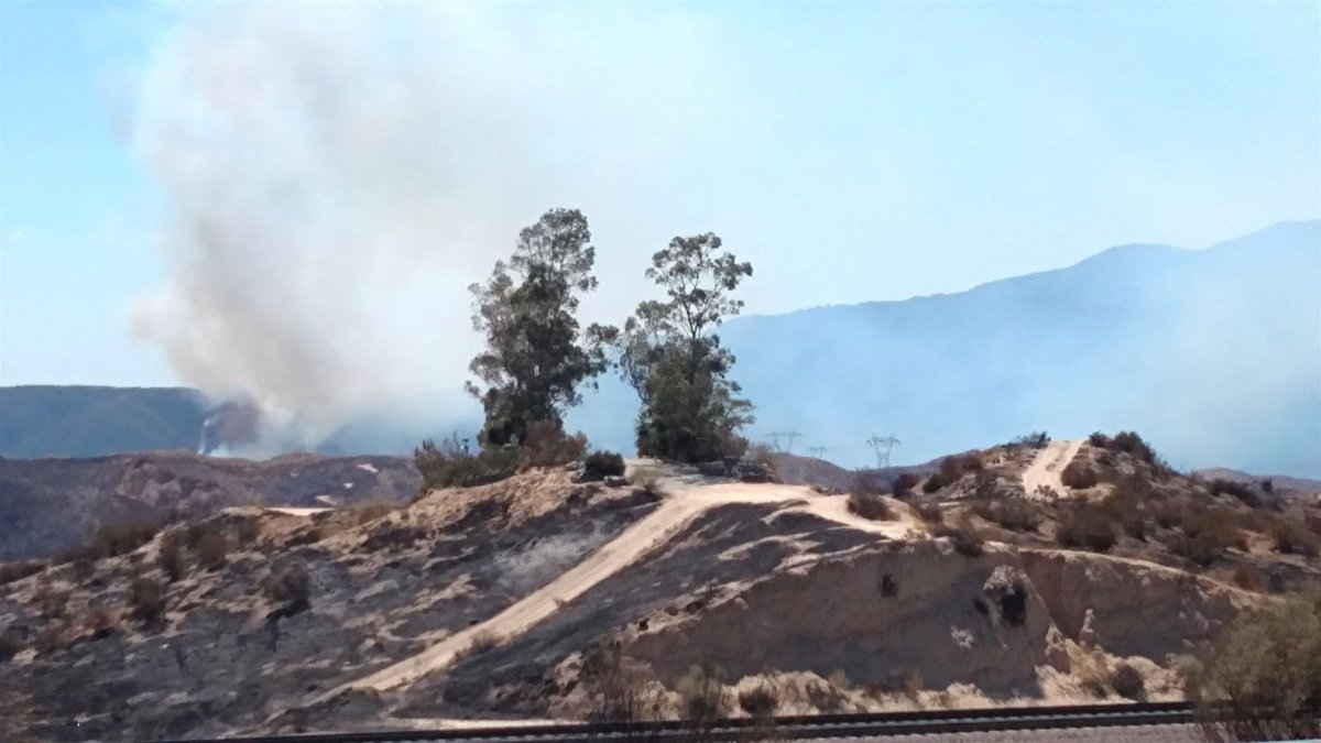
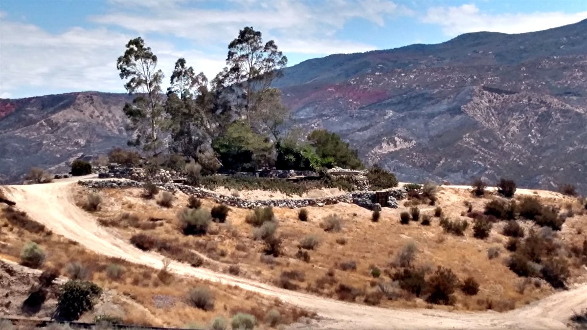
| August 18, 2016: Yes, Hill 582 is intact and survived the bad Blue Cut Fire !! | |
|
DET sent these 2 photos, taken today, by 'a
friend of Hill 582'. All things considered and after a quick look, the Hill APPEARS to have survived well. |
|
 |
 |
| 8/18/16 View from trackside BNSF MT-1 and MT-2 - BCF-30 | 8/18/16 View from West side - BCF-31 |
| Brief History of Hill 582 below |
|
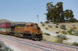
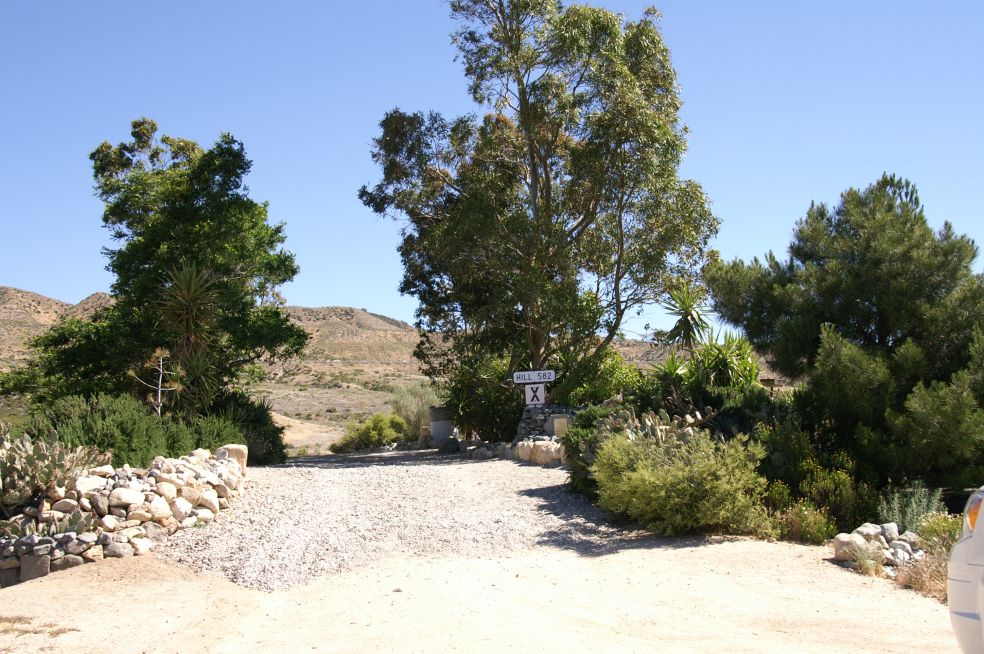
Buried deep within the "Proposed BNSF Cajon Third Main Track Summit to Keenbrook Joint EIS/EIR" is a section entitled TRAIN WATCHING AND PHOTOGRAPHY. The first paragraph reads as follows, "The Cajon Pass area is one of the most popular in the United States among railroad enthusiasts and photographers. The volume and diversity of rail traffic on BNSF and UPRR tracks attract railroad enthusiasts to numerous viewing locations, including: Cajon Summit / Hill 582 / Tunnels 1 & 2 / Alray / Mormon Rocks / Sullivan's Curve / Blue Cut / Cajon Station / Swarthout Canyon Road / Keenbrook "Train observers and photographers access vantage points using USFS roads and railroad service roads. In at least one location (i.e., Hill 582), an unofficial viewing site is maintained by and for train observers between the two BNSF main lines." Let me tell you about Hill 582. I'm Don Toles, and I am co-creator of Hill 582, the only viewing location on the above list that is man-made as well as geographical. Hill 582 is a north/south ridge located between the #1-2 and the #3 tracks near MP 58X. The former Southern Pacific tracks, now owned by UPRR, are located a short distance further north, and are clearly visible from Hill 582. The proximity to all four tracks makes Hill 582 one of the prime viewing spots in Cajon Pass. The name "Hill 582" comes from the 582A number plate mounted on the signal mast that prior to the 3MT project stood at the northeast corner of the hill on BNSF track # 1. The old signal mast was replaced by a full signal bridge during the 3MT project. Access to Hill 582 is provided by USFS road 3N48 aka Parker Ranch Road that runs from SR 138 to BNSF track # 3.
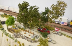
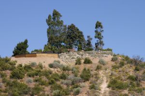
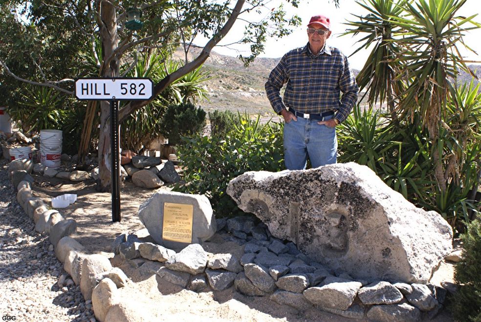
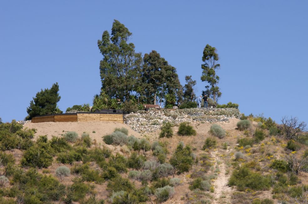
In 1992, I planted several Mojave Yuccas, an oleander bush and an elm tree on the hill. No particular reason for doing so, I just wanted to see if such plants would grow in Cajon's harsh climate. A year later I met Mike, and he became my partner in developing Hill 582. In 1993, Mike obtained a substantial quantity of used lumber that we used to build a retaining wall along the east side of the hill. We brought in sandy soil from a nearby wash to backfill behind the wall, thus giving us more usuable space along the narrow ridge that formed the hill. In June of 1994, we decided it would be nice to have shade trees on the hill. We first planted three locust trees along the west side. Black locust trees are found near the railroad tracks at several locations in Cajon Pass, probably planted by track gangs for shade. Since they have existed for many years solely on the natural rainfall, we figured they would be well-suited for Hill 582. One of the locust trees died almost immediately, but the other two survived and continue to provide shade during Cajon's hot, dry summers. The locust tree that didn't live was replaced with a silver dollar gum tree which is a variety of eucalyptus. Also during the summer of 1994, Mike and I began planting eucalyptus trees on both sides of the hill. Eucalyptus trees grow quite rapidly, and once established, they are drought resistant. And they provide shade! Also planted that summer were two tamarisk trees that I had rooted from cuttings taken from tamarisks growing along the I-15. Disaster struck on October 10, 1995. A motor home caught fire on the I-15, setting the brush on fire. I was on the hill at the time, and I watched a strong Santa Ana wind quickly pushed the fire downhill towards Hill 582. Fortunately, the fire was stopped when it reached the USFS road next to the Southern Pacific tracks. A helicopter and numerous pieces of fire equipment had brought the fire under control. By the fall of 1995 the trees on Hill 582 were growing nicely, and they were clearly visible from the SP tracks. Forest Service officials directing the fire effort couldn't help but notice the trees on the nearby hill. That's when the egg hit the fan! A few days after the fire, two Forest Service botanists visited the hill. They removed the two tamarisk trees and a dozen castor bean plants. I just happened to drive in that afternoon as a Forest Service truck was driving out. When I reached the hill, I could tell from the fresh dirt that it had just happened. I quickly concluded that the two women in the USFS truck were the likely perpetrators. Mike was determined to find out why the plants had been removed. He inquired at the Lytle Creek Ranger Station, and was able to speak to one of the botanists. He learned that it is illegal to plant anything in the National Forest, something that simply hadn't occurred to us. The botanist's demeanor, fortunately, was pleasant, and she offered to meet with us to discuss the situation. The following week, Mike and I met with the botanist and her supervisor at the Ranger Station, and they told us what we could and could not plant on the hill. They also told us we could apply for a special use permit, but warned that it would cost at least $10,000 for an EIR, and probably take ten years to get a decision. "You guys don't want to do that, do you?" We could tell from that remark that the Forest Service was not eager to deal with the permitting process. Neither were we! A week later, the botanist and her supervisor came up to Hill 582 to do a "walk-around" with us. Again, they told us what we could and could not grow. They had no problem with the Mojave yuccas, cacti and rosemary plants, as they are not considered to be invasive. They suggested several plants that would probably survive on the hill, including the Desert Bird of Paradise bushes that are now well-established near the northwest corner of the hill. They asked us not to plant any more eucalyptus or locust trees, since they are not indigenous to the area. Instead, they suggested that we plant pine trees, and they offered to donate pine trees IF we would be willing to transplant them from the tree "plantation" at Lytle Creek. We jumped at the opportunity, of course, and the pine trees have thus become our "connection" to the Forest Service. To accommodate a number of pine trees, we removed two of the eight eucalyptus and planted seven pine trees. Mike dropped out because of health concerns, but I continued to expand the hill during the latter 1990s, building wood retaining walls on both sides of the hill and eventually replacing most of the wooden walls with rock walls. In 1998, the Forest Service land use officer provided me with a short list of guidelines to follow in order for the hill to continue to exist. No concrete slabs, block walls or structures may be built, and the hill must not become "a magnet for trash." I have diligently followed the guidelines, and the Hill's several caretakers constantly pick up and remove the inevitable trash that visitors leave behind. The guidelines also require us to obtain permission from USFS botanists before planting any new varieties on the hill. Everything currently growing on Hill 582 has been approved by the Forest Service. I have no intentions of any further plantings, as it's all we can do to just keep watered what we already have. On June 17, 2002 a brush fire ravaged much of Cajon Pass. The fire, driven by strong southwesterly winds, burned along both sides of the hill, eventually reaching the I-15 freeway. The trees on the west side were badly scorched, and the wooden walls on both sides caught on fire. I watched from the SP tracks as the fire raged past the hill. A Forest Service Ranger standing with me predicted that all would be lost. Miraculously, the eucalyptus trees and the black locust survived, but three pine trees and several rosemary plants were destroyed by the intense heat. A one-year fire closure was imposed on Cajon Pass in July 2002. Two Forest Service technicians volunteered to escort me into Hill 582 several times a month during the summer to bring water for the plants and trees. One of the technicians also brought water in on his own, and he tried to keep the wildlife dripper supplied with water. Upon arrival of the rainy season, I was told that I could no longer be escorted in, but they would resume escorting me in the spring when the rains had ceased. During the six months that I was denied entry, several rosemary plants and one pine tree died from lack of water. The rest of the plants and trees suffered also, but most of them managed to survive. There have been several notable additions to Hill 582 in recent years. The Tony Andel memorial bench was placed in a shady spot on the east side in 1998. On Memorial Day, 2000, Mike Marzlo and three other railfans, including me, "planted" the drawbar and coupler on the east side near the north end of the hill. The drawbar became a memorial to Mike Marzlo in November, 2003, when the young BNSF diesel mechanic tragically lost his life in an automobile accident. Memorial plaques for William Garner, Dave Burton and Ed Delvers were also added to the drawbar site. A very recent addition is the Chard L. Walker memorial consisting of a brass plaque, the "582A" and the "G" number plates from the former signal mast that stood at the north end of the hill, and a large concrete remnant from the west portal of Alray tunnel # 1. Clearly visible are a portion of the 9 and the entire 13 numbers that were cast into the concrete to commemorate the completion of the tunnels in 1913. We owe a huge debt of gratitude to BNSF and the Ames Construction Co. for so generously providing Hill 582 with these historic mementos. I am also grateful for the several volunteers that bring bird seed, water and help maintain Hill 582 on a regular basis. Thank you Jerry, Lane and Marc! Don E. Toles, Highland, CA, June 2008 |
Here are the links for our "History of Hill 582" pages:
|
History of Hill
582 The Early Years 1991 - 2006 by Don E. Toles Updated: 1/17/26 |
|
| 12/01 - Gary & Don X-Mas 2001 - 068 | Read it and see all 108 photos - click here | 4/9/06 - Chard Walker, Don, Karl, Gary - 105 |
|
|
History of Hill
582 The Late Years 2008 - 2023 by Don E. Toles Updated: 1/17/26 |
|
| 12/29/08 - Triple meet, WB & 2 EB trains - 8139 | Read it and see all 498 photos - click here | 12/29/08 - Don Toles w/memorials - 8140 |
Copyright by Don E. Toles (with
permission Werner Meer)
Below are links of a visit to Hill 582 (May/June 2010) by Werner Meer
 |
Cajon Pass Hill 582 Part 1 by Werner Meer May 29 - 30, 2010 Updated: 7/22/10 |
 |
| WM 5/29/10 UP EB coming round the curve - 2119 | See all 204 photos - click here | WM 5/29/10 BNSF WB pass UP EB - 2131 |
 |
Cajon Pass Hill 582 Part 2 by Werner Meer June 1, 2010 Updated: 7/26/10 |
 |
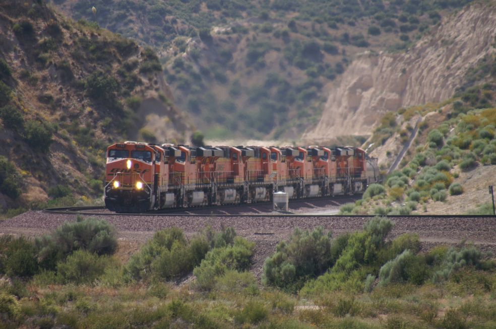
| WM 6/01/10 BNSF EB w/9 locos - 3222 | See all 239 photos - click here | WM 6/01/10 North side of Hill 582 - 3334 |
 |
Cajon Pass Hill 582 Part 3 by Werner Meer June 2 + 4, 2010 Updated: 7/31/10 |
 |
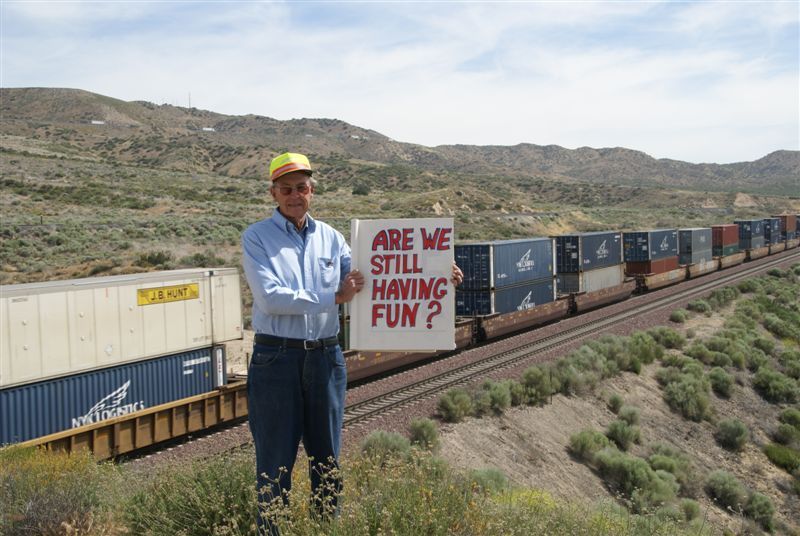
| KS 6/02/10 - Don with question - we say, yes - 161 | See all 261 photos - click here | WM 6/02/10 - Railfanning at its best - 2604 |
Below are photos of a visit to Hill 582 (June 2017) by Peter Roesner
 |
Album 54 Cajon Pass Hill 582 Photo Collection June 2017 Photos by Peter Roesner (Switzerland) Updated: 9/10/17 |
 |
| Hill 582 view from Southside - PR-79 | See all 90 photos - click here | Hill 582 view from Westside - PR-82 |
|
8 different and detailed Maps of Cajon Pass with
captions (Mile Posts and Location) by Gary G. Gray - click
here New 8/11: Maps "How to find" Hill 582, Sullivan's Curve, Noisy Point by Gary G. Gray - click here |
| Accurate Map of Cajon Pass with 3rd Main Track by Michael Amrine - click here |
New 4/11: Interesting report (Adventure Blog) about Hill 582 by Kris
Larsen, Hesperia, CA - click below:
http://larsenadventurechronicles.blogspot.ch/search?updated-max=2011-04-23T14:18:00-07:00&max-results=7
| Below are links to the Cajon Pass Photo Collection by Don E. Toles, Gary G. Gray, Marc Fournier |
| Cajon 1 with 2006 photos - click here | Cajon 2 with 2007 photos - click here | Cajon 3 with 2008 photos - click here |
| Cajon 4 with 2009 photos - click here | Cajon 5 with 2010 photos - click here | Cajon 6 with 2011 photos - click here |
| Cajon 7 with 2012 photos - click here | Cajon 8 with 2013 photos - click here | Cajon 9 with 2014 photos - click here |
| Cajon 10 with 2015 photos - click here | Cajon 11 with 2016 photos - click here | Cajon 12 with 2017 photos - click here |
| Cajon 13 with 2018 photos - click here | Cajon 14 with 2019 photos - click here | Cajon 15 with 2020 photos - click here |
| Cajon 16 with 2021 photos - click here | Cajon 17 with 2022 photos - click here | Cajon 18 future |
| History of Hill 582 photos - click here | Ranchero Road Project - click here | Colton Flyover Project - click here |
| Highway 138 East Project - click here | Mojave River Bridges - click here | Green Tree Blvd. Project - click here |
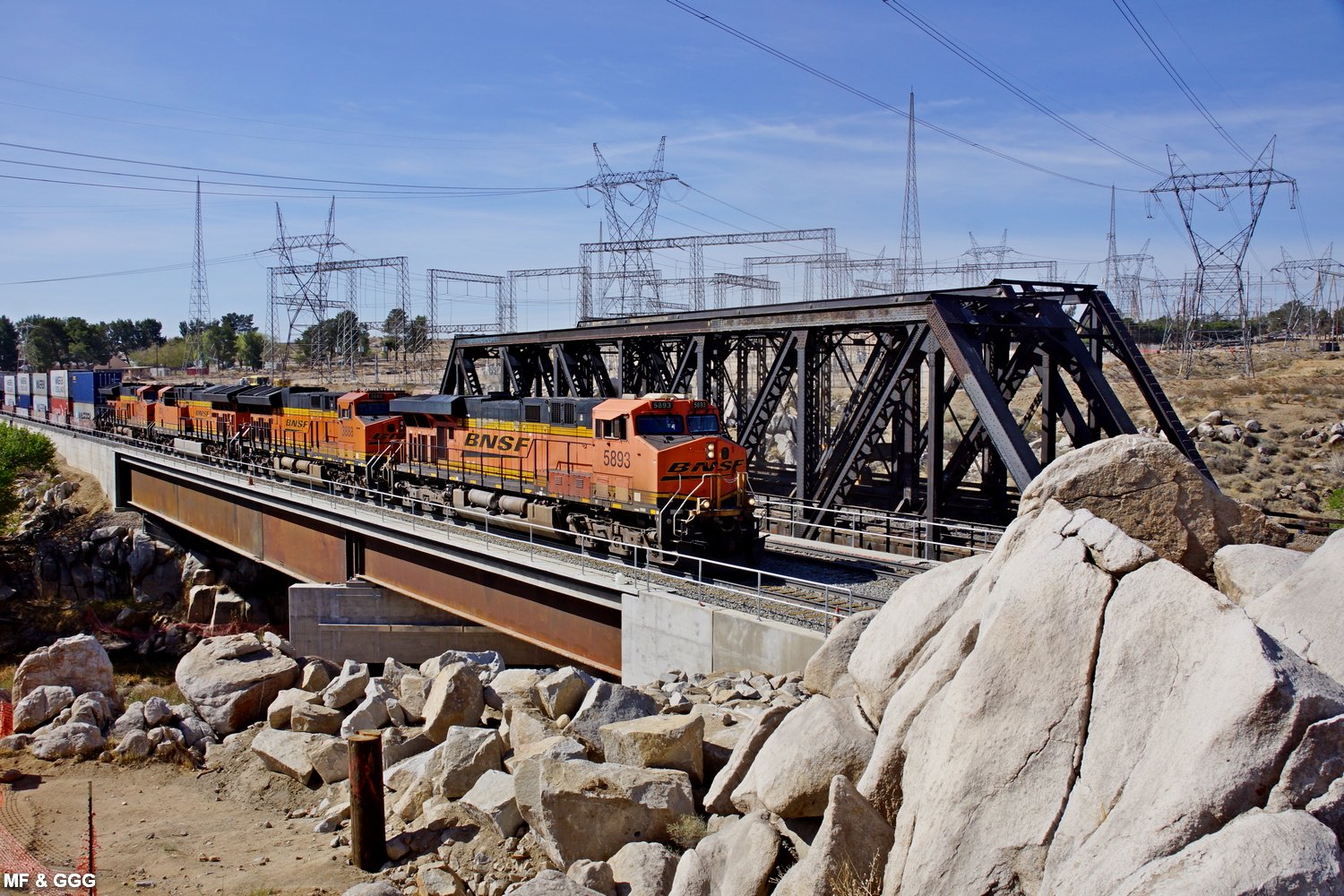
-MFX.jpg) |
Cajon Pass
Sub BNSF Mojave River Bridges Replacement East Victorville, CA 2020-2021 MP 34.1 (East Victorville, CA) Gary G. Gray, Marc Fournier (USA) Updated: 6/01/21 |
 |
| MF 1/11/20 BNSF 5886 DPU EB - 2011 | See all 684 photos - click here | MF 4/06/21 BNSF 5893 EB on new bridge - 2691 |
|
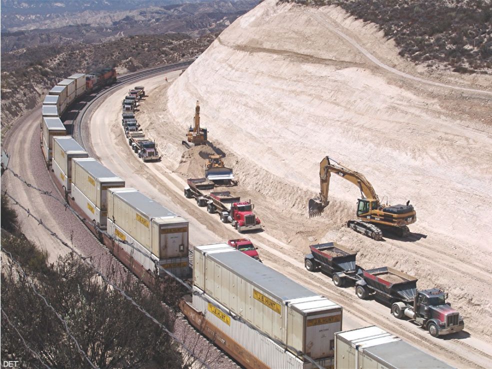
Cajon Pass 3rd Main Track Construction by BNSF in 2007 and
2008
BNSF was building a 3rd Main Track thru Cajon Pass. It was built along the # 1 (north) track (2,2 % grade). The only 2 tunnels in Cajon have been daylighted. This one of a time project was completed on November 07, 2008. |
||
 |
3rd Main Track Project by BNSF 2007/2008 outstanding coverage on 9 Albums Photos by Don E. Toles, Gary G. Gray and Marc Fournier taken from 6/22/07 to 12/24/08 |
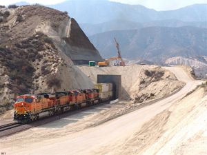 |
| DET 8/24/07 Summit Curve - 061 | See all 9 pages with 896 photos - click here | DET 10/25/07 T-2 EP w/BNSF EB train - 197 |
In Memory of Chard L. Walker (1922 - 2007) - click here
Go back to Cajon Pass Main Page - click here
Over all copyright by Werner
Meer 2026
-MF.jpg)